July 17, 2012

Wisconsin

Monday morning was a long day of driving with a few stops along the way. My first hurdle was getting through Chicago during rush hour. Jack ended up taking me into the streets since the highway was so backed up. It actually wasn't too terrible.
I made a scenic detour up into Door County, WI and stopped in Sturgeon Bay. There is a coast guard station there with a lighthouse and breakwater pier.  The water was really pretty here and crystal clear.
 
 
It had a nice little beach but it was kind of intimidating because the access road was very clearly delineated:
  

 Next I headed over to Potawatomi State Park. This is the terminus of the Ice Age National Scenic Trail. Throughout the trip I had come across portions of the North Country trail so it was nice to check out another trail (Especially a terminus!). 
  
There is an observation tower that gives you a great bird’s eye view.
  
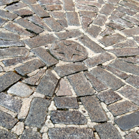
 I also did a short walk along the water’s edge just to say I’d been on the Ice Age trail. The trail is currently only 600 miles but it planned to be 1,200 miles when complete. The trail roughly follows the location of the terminal moraine from the last Ice Age. It was actually pretty cool because of the unique rocks along the edge. The Great Lakes aren’t known for having a lot of sandy beaches.  
My resting spot for the night was Governor Thompson State Park. It’s a very new park and the bathroom facilities were awesome. I made dinner and relaxed as thunder rumbled overhead. I wasn’t too worried as I figured the storm would pass. Wrong! The thunder rumbled and lightning flashed and the rains poured down until I left the next morning. I had never experienced a storm lasting that long. Because of all the lightning I ended up sleeping with my pillow over my head to block it out. When I awoke in the middle of the night to see what time it was I realized that my tent had blown in on itself and the floor was sopping wet. I gave up at that point and headed into Captiva to sleep the rest of the night away. The car was actually very comfortable to sleep in. I got up first thing Tuesday morning and bundled up my sodden tent and left.

July 16, 2012

Indiana Dunes

I stopped for lunch at Historic Bridge park because the North Country Trail (a NPS trail) headed through there. Dad and I had checked out part of the trail in PA last year so it was nice to see another section (enough to make me realize I would never walk the entire thing). Anyway the park was full of old bridges which I thought was a really neat way to preserve history.

 I cruised west into Indiana and gained an hour with the time change. As I pulled up to the visitor center of the Indiana Dunes National Lakeshore I noticed that the clouds were rolling in and it was getting really dark. The ranger assured me that the visitor center was hurricane and tornado proof. My fears were not assuaged when someone mentioned tornado but it turns out it was just a severe thunderstorm warning. I waited the storm out by viewing a few visitor center films. Soon the rain had stopped so I headed out to Mt. Baldy where I waited a few more minutes for the thunder to stop before climbing a sand dune. 
The Indiana Dunes are unique in that they are a haven for biodiversity but the pristine lakeshore is ruined by nuclear reactors and other factories lining the distant shores. 

I also walked a quick dune loop and checked out the Bailley and Chelberg farm which I really liked. 

The Chelberg farm has a lot of maple sugaring equipment and does a lot of historical interpretation of that in the spring. They were both very well preserved houses and the storm had cleared people out so I was one of the only ones there. 

I don't know what this thing was (it's covered in dried flowers) but I thought it was so beautiful.

 I ended the day at Indiana Dunes state park by enjoying the beach. There was a group of people banging drums, chanting and doing some sort of Brazilian karate fighting dance. 


July 15, 2012

Great North July Fourth

2 years ago for the Fourth of July holiday I did a whirlwind trip to Northern Michigan in 4 days. When I found out that our company was giving us an entire week off this year, I immediately thought that’s where I wanted to go back to (as I didn’t want to venture into Northern Minnesota in the winter). Dad and Don gave me the idea to rent a car for the trip and save old Grey Rock the trouble. I was resistant because I love my car and she has been with me on most every roadtrip and I know just where everything fits. Plus renting a car costs money and that is not something I part with lightly. But the seed of doubt was in my head so I booked a car and ended up with a Chevy Captiva. I was doubtful as I like trunks and not hatchbacks but she quickly won me over with her leather seats, back up camera, sunroof, and other plush amenities. I set off Saturday morning in Captiva and headed west to Marblehead State Park in Ohio. 

There is a lighthouse there and across the water you can see Cedar Point (the famous amusement park). It was a nice spot to get out and stretch my legs. My ultimate Ohio destination was Perry’s International Peace Memorial on Put In Bay Island. It is the only international peace memorial and the last NPS site I had to hit in Ohio. I had originally planned just to view it from shore but my conscious stabbed that it was cheating so I boarded the ferry to Put in Bay island. You can drive there but the island is overrun with golf carts (and roads not designed to hold both) so I caught the bus from the ferry drop point to downtown. The memorial is in honor of Commodore Perry and commemorates the War of 1812.
 It is 352 feet high and you usually can climb it but it is currently undergoing renovation so I just walked around the base. I also checked out the main thoroughfare in downtown Put in Bay but it didn’t appeal to me so I hopped back on the bus to take the ferry back. 
I wanted to get to River Raisin National Battlefield Park before the visitor center closed at 5. I crossed over into Michigan and pulled up to the visitor center at 4:45. I grabbed a few postcards and wandered around the reenactment that was outside. Apparently there was a celebration that day and a military band had performed but they were closing down for the day. River Raisin is one of the newest units of the NPS and was only established in 2010. It is still under development but there were some interpretive signs. 
I think it will be really cool to come back in the future and see what it has turned into. It’s so exciting to visit such a new NPS unit. The battle cry after this battle was Remember the Raisin! As the British Indiana allies had slaughtered the American prisoners the day after they had surrendered. Today was such an interesting day because the places I visited focused on the War of 1812 which I really only remember the name of but no details. That’s why I love national parks. My campground was right down the road and located right on the River Raisin. I settled in for the night and tried to imagine how the river looked to the soldiers who fought in the battle.
The next day I woke up bright and early and it was already in the 70s. I headed out to the Navarre Andersen trading post which is on the National Register of Historic Places and is the oldest woodedn structure in Michigan. It looked like any old house to me but I appreciate a historic structure. 
I also checked out the Custer statue as Custer was married in Monroe. 
And a historic Catholic church
But my favorite thing in Monroe, MI is the Rotary park. They have an amazing wooden playground! My elementary school had a wooden playground and it got torn down when I was in high school. The only other time I’d seen a wooden playground was in San Antonio so I pulled over and happily reminisced about my childhood (although this playground was set in mulch while ours consisted of gravel). It’s so disturbing that so few wooden playgrounds exist anymore. What kid can’t handle a few splinters every now and then!?
 I played around for about a half hour on that playground and nearly threw up after winging myself around the tire swing. It was a great way to spend a Sunday morning. After that trip down memory lane I turned on my Motown Music and headed into Detroit. I drove past the GM headquarters and then trolled up Woodward Avenue which is an All American road.
 When I had researched it online it seemed like it would be packed full of historic stuff and I guess it was but I was looking for signage and I didn’t see any. I plugged a few addresses into Jack and he took me to abandoned parking lots and dead end streets with derelict warehouses so I decided I had seen enough “history” and headed west again. 

June 19, 2012

Memorial Day

For Memorial Day I had several stops planned before I headed back home. I didn't have the time to ferry out to the Boston Harbor Islands so I had to settle for visiting the islands that are accessible by car. Deer Island that I stopped at on Saturday was one of those. I headed out to Worlds End first. It is managed by the Trustees of Reservations which means there is a fee. At least I got a map but I did not find it very helpful. I ended up walking a huge loop back to the parking lot before I got re-oriented and set off to find the view of Boston. This site was also planned by the legendary Frederick Law Olmsted so it was gorgeous. I can just picture a horse and carriage meandering through there.
Carriage roads
I did finally end up in the right place to check out a gorgeous view of the Boston Skyline. It was a bit overcast but by the time I walked back to my car the sun was out.
Just down the road is Webb Memorial State Park:  It is a more urban park and there are great walking trails that go around and through the island. There were plenty of people out enjoying the day.

My next destination was Adams National Historic Park. On the way, I passed by a  cute little down that had red, white, and blue stripes on the road. How patriotic!

I also swung by the Abigail Adams Birthplace which is just on the roadside. 


In Quincy, the John Adams and John Quincy Adams Birthplaces are the oldest presidential birthplaces in the United States (and only 75 feet apart!)  
 
 
I headed into downtown Quincy to the Visitor Center to inquire about a tour but decided not to take one. The next one didn’t start for over an hour and the tours last 2 hours because they have to trolley you around between the different locations and I didn’t have time. 
While I was checking out the church where the Adams’ are buried the Memorial Day parade started so I sat and enjoyed it for a bit. There were no vintage cars or tractors though which was weird (must be a Scottsville thing).  I walked over to the Old House at Peace Field which was the residence of the Adams family for four generations from 1788 to 1927.
My final stop was Nut Island. There really was just a fishing pier there but it allowed me one last look at Boston before hopping back in my car and cruising back home. 
I was really daunted by this trip because there was so many stops I had to see but because none of the sites are too expansive, it was quite manageable. You'll notice that my pictures are much darker and that's because my camera battery died and when I reached into my bag to replace it, I realized I had left my spare battery at home, charging in the wall. Luckily I had my underwater camera as a backup. All in all, it was a great trip and I really enjoyed soaking up all the NPS sites in Boston.

June 18, 2012

Freedom Trail Part II

Continuing on the Freedom Trail...

Old South Meeting House:
When it was built in 1729, it was the largest building in colonial Boston. It is best known as the site of where the Boston Tea Party began.
 Old State House: This house was occupied by the British during the Revolution. On July 18, 1776, citizens gathered in the street to hear the Declaration of Independence read from the building's balcony, the first public reading in Massachusetts.
Boston Massacre Site: In front of the Old State House, there is a circle of cobblestones to commemorate the Boston Massacre. 5 colonists were killed.
http://www.cityofboston.gov/Images_Documents/Bsoton_Masacre_200x200%5B1%5D_tcm3-2655.jpg
Faneuil Hall: I had been here before when I went to downtown Boston to celebrate Amy's 21st birthday. However that was on a cold December night when there wasn't much going on. Coming back in May, it was much more hopping. Faneuil Hall is basically a huge marketplace and has been since 1742. The NPS visitor center recently moved here.

Quincy Market: By the time Boston was incorporated as a city in 1822, downtown commercial demand grew beyond the capacity of Faneuil Hall.To provide an expansion of shop space, Quincy Market was built, as an indoor pavilion of vendor stalls. It is quite overwhelming to walk through and I just pushed my way through as I wasn't interested in buying any food. The smells are all quite delicious though.

North market is another extension of Quincy Market.
 
  Paul Revere House: The oldest building in downtown Boston (built around 1680). It was the home of silversmith Paul Revere and his family from 1770 to 1800.
http://www.smsc-home.org/images/Paul_Revere_House.jpg

Old North Church: Boston's oldest Church building. The steeple is 191 feet tall, making it the tallest steeple in Boston.


Copp's Hill Burying Ground: Boston's second oldest burying ground.
Then it was time to cross the water for the last leg of the Freedom Trail.

Charlestown Bridge
  The USS Constitution is the oldest commissioned warship afloat in the world. It was first launched in 1797. You have to go through security to enter the visitor center and can then decide to go on a guided tour that goes into the ship or a self-guided tour that just allows you to explore the deck. Due to timing, I opted for the deck. I had never been on a ship this big before and it was a lot to take in.
     The USS Cassin Young was the other ship at the Yard. I had never seen a ship in dry dock before and it was really cool, especially learning about the process.

My final stop of the day was at the Bunker Hill Monument. It is 221 feet tall. My feet were so tired from walking all over that I sat on the hill overlooking Boston and got a good rest before I had to head back to the subway station. I got there after 5pm so I was unable to climb it but I honestly didn't have the energy even if it had been open.

The Freedom Trail is a great way to spend a day because it offers a little bit of everything and all you have to do is follow the red brick road!