July 28, 2013

White Sands


My last stop of the day was at White Sands National Monument. I passed through a dust storm on the way there and the temperature quickly climbed to above 100 degrees. So naturally I decided to go hike a 1 mile dune trail in my flip flops with no water. 1 mile seems much farther on sand. I kept getting freaked out because the trail is across sand so you have to look to see where the markers are in the sand to follow it. The scenery was spectacular though.

Finally I drove into the heart of the park and it was stunning. The white sands dunes are made up of gypsum crystals and make up the worlds largest gypsum dunefield.


 Everywhere you look is just completely white. It reminds me of a snowstorm. I was there in the evening so there weren't a lot of people around so I stopped at a variety of different dunes to take in the vista. On the nature hike I had some sun but the clouds started rolling in but I still got some great shots.

The plan was to do a ranger guided hike but as we were gathering the ranger informed us that her lightning detector was going off and the hike was cancelled. The sky was looking pretty foreboding so I hightailed it out of there to safety. 

I encountered a pretty wicked duststorm but luckily I made it to my hotel just in time. I'm so glad I finally got to see White Sands. I really loved Great Sand Dunes in Colorado but the vastness of these pristine white dunes coupled with the stormy weather made for a really unique atmosphere that I really enjoyed.

Salinas Pueblo Missions

The next stop on my National Park checklist was the Salinas Pueblo Missions. They are a collection of three discontinuous units, each with distinct Spanish Missions, Native American Pueblos, and a variety of other historic buildings and ruins. A combination of disease, drought, famine, and Apache raiding led to the abandonment of all the ruins but they are each spectacularly preserved.

My first stop was at Quarai ruins which is the smallest of the three units at approximately 90 acres. Pueblo Mounds at the site suggest that prior to Spanish contact, Quarai was a very large pueblo. This fact is mainly due to the presence of a year round water source flowing from springs along Zapato Creek which is why this site was fairly lush.
The Quarai Mission and Convento were established at Quarai in 1626 and abandoned in 1678. Settlers would return to Quarai in the early 1800s constructing the Lucero Structures which included a defensive Torreon and the later Manzano Church. 
A wedding had taken place the night before


Next up was Abo Ruins which is approximately 370 acres. 

The number and size of unexcavated pueblo mounds suggest that when the Spanish arrived in 1581 they would have found a thriving community.  Abo was abandoned in 1673. In 1815 Spanish sheep hearders attempted to return to the area, but were pushed out by Apaches in 1830. Settlers would permanently return in 1865.
  
What I found interesting at these first two pueblos is that both contained kivas which is such a huge contradiction from the churches being established as Missions. As best as anyone can guess, the kivas probably aided in early conversions.
Abo Circular Kiva
The last (and biggest) was Gran Quivira which is the biggest of the three units at 611 acres. Prior to Spanish contact, Gran Quivira was a vast city with multiple pueblos, and kivas. First contact with the Spanish probably happened in 1583. The Spanish returned in 1598 with the expedition of Don Juan de Oñate who was the first Spaniard to colonize what would become New Mexico. Gran Quivira became a a satellite mission of Abo in 1629. That same year construction began on the first permanent mission at Gran Quivira. By 1672 it was abandoned.


This one was by far my favorite of all the missions I had seen. It is absolutely massive and its not even fully excavated. The view was just spectacular and you can explore throughout a variety of different pueblos.

Petroglyphs National Monument

The next morning dawned hot and sunny in Albuquerque. My plan was to immediately leave the city but as I headed out I passed a sign for Petroglyphs National Monument and I couldn't resist stopping by. Jess and I had conquered this site on our Labor Day 2008 roadtrip but the one spot we didn't get to was Rinconada Canyon. Actually we did make it there but the spot was closing for the day and we saw 2 guys with shovels hiking in so we wisely left. This time, at 7am in the morning, there was only a woman and her dog hiking around so I felt much safer.

The trail is 2 miles long round trip and is packed full of petroglyphs. Archeologists believe ancestral Puebloans made most of the 1,200 petroglyphs in Rinconada Canyon 400 to 700 hundred years ago. Pueblo elders believe the images are as old as time. They also believe that the petroglyphs choose when and to whom they reveal themselves. I was privileged to see many of them.


I was so glad I had stopped at the canyon and taken the time to hike in. I was riding high on petroglyphs so I decided to stop by Boca Negra canyon which is the main area of the park. The highlight is the Mesa Top trail which leads to a 360 degree view of Albuquerque. 
What is most fascinating to me is that no one can say for sure what many petroglyphs portray. Native peoples may hold complex and widely varying interpretations of many images, depending upon context. It is not always appropriate to even reveal the meanings of images so it is really up to each person to see what the petroglyphs mean to them.

Finally leaving Albuquerque I headed out through the National Forest on my way to the Salinas Pueblo Missions. The forest was closed due to such extreme fire danger but it was still beautiful.

Albuquerque


This year has been a crazy whirlwind of work and adventures but I have the privilege of working for a company that closes down for the week of July 4th so with that I took a much needed vacation. It has been 4 years since I have been out West and I have been missing it sorely so the plan was to spend most of the week at Meris' ranch but since she still had guests I decided to avail myself of the national park sites around Albuquerque.
 My first stop was El Morro National Monument. It is located on an ancient east-west trail and the main feature is a great sandstone promontory with a pool of water at its base.
 Due to the water, this site has seen many centuries of travelers. The remains of a mesa top pueblo are atop the promontory where between about 1275 to 1350 AD, up to 1500 people lived in this 875 room pueblo. The view atop the mesa was spectacular. 
Travelers left signatures, names, dates, and stories of their treks. While some of the inscriptions are fading, there are still many that can be seen today, some dating to the 17th century. It was so crazy to me how long varied these inscriptions are. There are simple names all the way up to a paragraph in cursive writing! There are also some pictures carved out.
When the park was first founded park rangers thought it would be a good idea to color in the inscriptions to make them stand out but  now the park is doing a lot to preserve these carvings the correct way.
The sister park to El Morro is El Malpais which is from the Spanish term Malpaís, meaning badlands, due to the extremely barren and dramatic volcanic field that covers much of the park's area. The best way to see this park is by hiking but there are some places you can drive to if you don't have a lot if time.
Sandstone Bluffs
The coolest place is La Ventana arch which is the second largest natural arch in New Mexico. The landscape around there was gorgeous. 

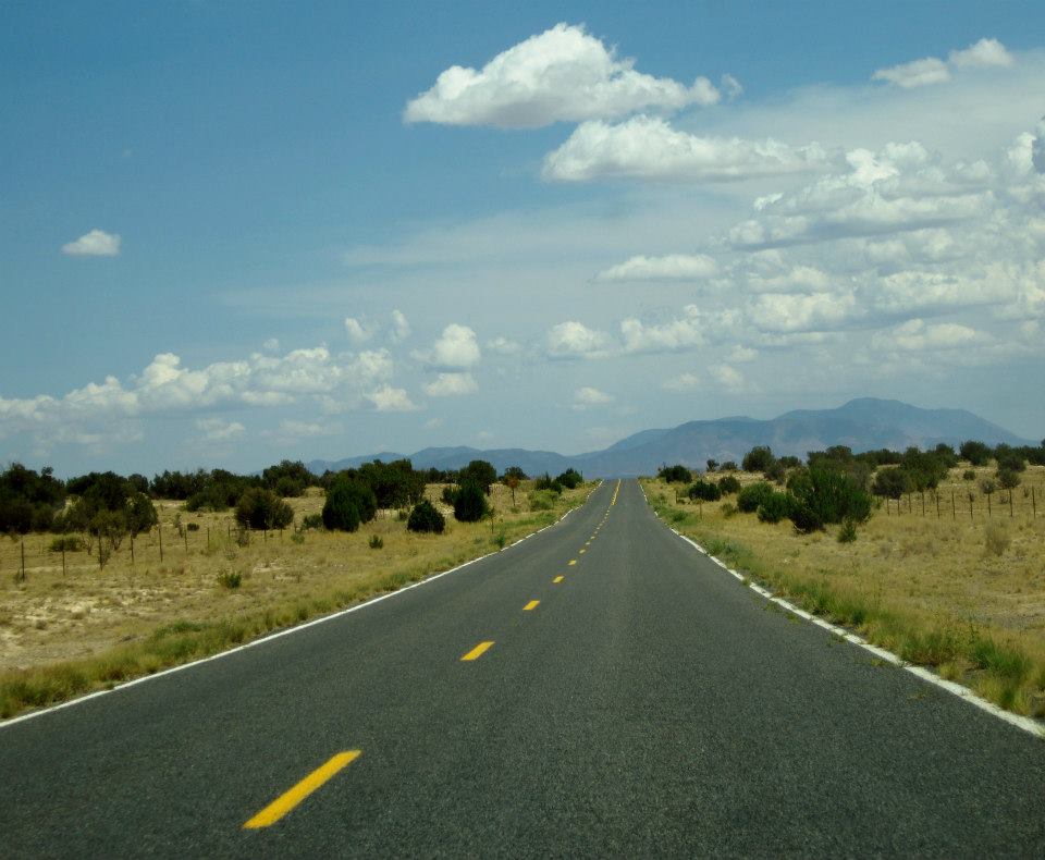
The whole afternoon I passed rarely a car and every site I went to only had a handful of people.  It was so nice to be out in the wilderness again and I had sorely missed driving down wide open roads where your site is only limited by the horizon. Showers were also passing through which kept it nice and cool and gave the sky some beautiful clouds.
Flowering cactus