September 21, 2011

Seaway Trail

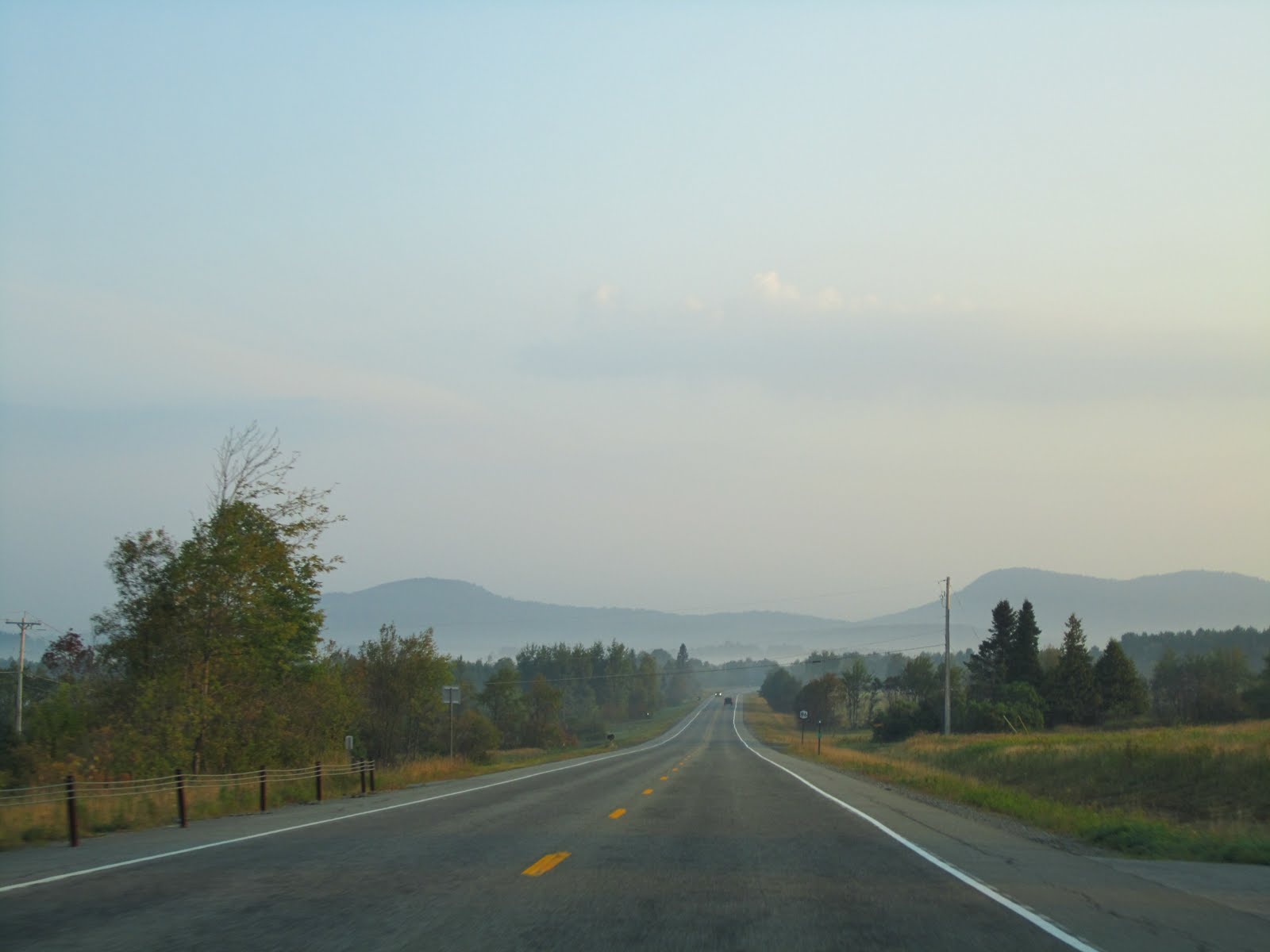
At about 10pm Sunday night it started raining and it rained the entire night. I got up Monday morning and packed up everything soaking wet and headed out. I drove west out of the mountains and went all the way over to Tibbitts Point Lighthouse in Cape Vincent, NY. Cape Vincent is where the St. Lawrence River meets Lake Ontario so it was an interesting spot to see. The lighthouse is at the end of a dead end road that follows the lake shore and the houses along it are stunning. I then meandered along the Seaway trail the rest of the way home, stopping at a few more lighthouses along the way.

The Selkirk lighthouse

A tugboat at the H Lee White Museum in Oswego

The Oswego lighthouse

And finally the Sodus Bay lighthouse

I had a really nice time exploring the Seaway trail and it was a nice relaxing drive. I made it home around 3:00pm, tired, sore and wet but still exhilarated from another exciting Labor Day excursion!

September 19, 2011

Summer in the Adirondacks

Even though my digital camera was destroyed by rain, I am always prepared and I went to my backup- a Kodak Funsaver Instant Camera. I've carried this camera around for 2.5 years thinking it would come in handy some day. Well that day finally came. It really made me appreciate every picture since I only had 27 exposures to get me through a day and a half.
After stumbling back to the parking lot, I changed into dry clothes and headed off towards the Santa Clara tract of wilderness to do some shorter hikes.
It was a very remote area and I enjoyed the quiet drive, even though it was pretty cloudy.However, I wasn’t really feeling the two trails that I had planned to hike so I headed back to Saranac Lake. Along the way though I stopped at Lake Clear beach. It’s not marked by any sign and I have no I idea why not since its gorgeous. It’s a short path to 2,000 feet of sandy shoreline on the huge Lake Clear. There was only 2 other couples on the entire beach. I promptly whipped my shirt off and proceeded to lie in the sun and try to dry out my soaking wet bra (it worked like a charm). Eventually though some clouds rolled in and I left. I decided to hike Mt. Baker in Saranac Lake since it was only 2 miles roundtrip with about a 1,000 foot ascent. Again, I was sweating my way up and cursing my decision to hike (especially since I had to put back on my soaking wet hiking boots). However, the views from the top were really pretty. A bit more of an urban view but still nice. It was getting cloudier and I feared getting stuck in another storm so I headed back down. I was done hiking for the day so I decided to be a tourist and go shopping in Lake Placid. I didn’t buy anything but it’s always interesting to browse the main drag of a touristy town. Fun fact- the town of Lake Placid is actually on Mirror Lake. Since the sun was shining strongly I decided to do one more easy walk along Lake Placid. So easy that I just decided to go in my flip flops. Well that was a poor decision because the trail was an absolute mess from Hurricane Irene. Branches and limbs were everywhere and massive trees had fallen over parts of the trail. I don’t even know why the trail was open. It still was nice to walk along the shores of Lake Placid though. I finally headed back to my campsite and decided that I wanted BBQ for dinner since it’s basically in my backyard. I got a delicious BBQ pork sandwich and a side of sweet potato fries and it was a delicious way to end the day.

September 17, 2011

And the Thunder Rolled...

Looking at the weather report for the weekend I saw that it was supposed to rain every day. However, Saturday had turned out brilliantly so I called Dad and asked him to check the radar for Sunday so I could plan my day. He said Sunday would feature afternoon showers so I got up bright and early Sunday morning and was hiking St. Regis Mountain by 7:15am. I was the only one on the trail and the sun was filtering through the trees so it was very nice. It’s about 3.5 miles to the summit and the last bit was a strenuous uphill haul. While I was nearing the top I started hearing rumbles of thunder. That can’t be right I thought, it’s 8:45 in the morning. I looked around and saw blue skies and sun through the trees but when I finally broke through tree line I was greeted by this view:

Off to the west clouds were swirling and rapidly descending over the mountain. I grabbed a few quick pictures, shook my fist at the closed fire tower and proceed to run pell mell down the hill. I have no idea how I did not break a bone or impale myself on something because I was vaulting over rocks, swinging off trees and using my improvised hiking sticks as crutches. What took me almost an hour to climb up, took only about 20 minutes for me to plummet down. Then the skies opened up and the forests darkened and the lightning flashed and the thunder boomed and I hauled ass. It was over 2 miles to my car so there was no way I was getting to safety anytime soon so I just tucked my head and kept up my brisk pace. Luckily the temperature didn’t fall too much, since I was only wearing a tank top and shorts. Finally my adrenaline rush faded and I was walking along soaked to the skin. Eventually the sun started shining again. As I got closer to the trailhead I met a guy going the other way (dressed in full rain gear) and he took one look at me and said “you’re a real trooper huh”. Ugh. I wanted to take a picture because I looked quite a sight but my camera was a victim of the deluge. Lesson learned!

September 15, 2011

Ampersand: The Best View in the Adirondacks

I had planned on going to my campground after leaving Panther Mountain and then hiking a mountain near there but I had gotten a book about hikes in the Adirondacks and saw that I was close to Ampersand Mountain which is supposed to be really nice. Plus its only 5 miles round trip, not 6.5 round trip like the other hike I had planned. However, I never really looked at the elevation gain, which is something I really need to give equal weight to. I always figure that it’s a mountain so obviously the trail goes up to the top and then back down so who cares what the elevation gain is? Well Ampersand goes up an abrupt 1800' of elevation in 2.7 miles with 1500 of that in the last mile. That was when it was pretty much straight uphill over wet, muddy rocks. Apparently this trail was infamous for being one of the most unpleasant sections of trail in the Adirondacks. It was a steep, rutted, slippery, eroded mess until the late 1990’s. At one point you even have to climb up the roots of a tree that are spread over a rock. Then finally you see a sheer expanse of rock with yellow arrows and are greeted with this view:

While Ampersand is probably the toughest hike I’ve done in the Adirondacks, it definitely has the best view by far. Here I am looking worn out after my arduous hike up.It’s only 3,352 feet high but the summit is bald, massive and unusually long, extending east to west and affording a variety of vistas in every direction. The mountain itself stands separate and alone, overlooking a vast expanse of lower landscapes and lakescapes on all sides. Ampersand also happens to be scenically situated between the northern lake country of the Adirondacks and many of the High Peaks and other mountains of the region. I stayed up for about a half hour trying to take it all in. There was a lot to explore on the summit if you were daring. By jumping over a few crevices I came across this sign commemorating the Ampersand Hermit- Walter Channing Rice, who manned the fire tower from 1915 to 1923. I then played around with my camera to get some self-timer shots. Finally, I decided it was time to head back down. I checked out some cave type things that I passed on the way up.I made it to the end of the trail around 5:00pm, covered in mud. I hopped in my car and took the scenic route to my campground. I stayed at Meadowbrook Campground and it’s definitely one of the weirder campgrounds I’ve stayed at. It’s on the main drag next to a Ford dealership and behind a BBQ restaurant that plays live music until 9:30pm. My spot was in the woods at least. I had to do some quick cleaning since Irene had knocked down quite a few limbs. I refueled with some chicken corn chowder and read while trying to tune out the blues music.

September 14, 2011

2nd Annual Labor Day Trip

With all my travel going on this year, I was getting kind of burned out and decided to just stick close to home and head back to the Adirondacks for the second year in a row. I decided I wanted to hike Mt. Marcy which is the tallest mountain in New York. I planned out my trip and was all set to go when Dad casually mentioned to me on Wednesday that I may want to double check to see if everything was still open because of the hurricane. Why wouldn’t it be I thought, because I hadn’t heard anything about the Adirondacks on the news; it was all focused on the Catskills and Vermont. Well I searched for “Hurricane Irene”+”Adirondacks” on Thursday morning and discovered that the entire Eastern half of the Adirondacks was closed because of damage. Not only was the trail bridge over the Marcy Dam wiped out but the road to the trailhead had collapsed and trapped 30 people on the other side! So I had a few hours on Thursday to completely re-plan my trip. I wasn’t too upset though because my main goal for the weekend was just to get away and do some camping and hiking.

I left after work on Friday and drove over to the eastern shores of Oneida Lake where I camped at Verona Beach State Park. I got there with just enough time to set up my tent and enjoy the sunset over the lake. It was a very nice spot.

Saturday I headed up into the mountains my first hike was Bald Mountain which is just outside of Old Forge. It’s a short hike up to the Rondaxe Fire Tower.

It's an interesting view because you have a good view of the Fulton Chain of lakes (8 lakes that are connected)

I really liked this hike because the views were great even without climbing the tower. It was just starting to clear up as I reached the summit so the pictures are pretty cloudy but by the time I got to the end of the hike, the sun was out.

The trail was interesting because it was across some slick rock When I got back to my car, I rolled the windows down, cranked up the tunes and drove off towards my next stop. I made a quick stop in Long Lake to check out the float planes. I sat around for a bit waiting to see if one would take off but they didn’t so I continued on. I drove through Tupper Lake and headed east until I hit the trail head for Panther Mountain. It’s only 1.4 miles round trip so it was a quick hike. However, the views were really not that much from the top.